
In June 2013 the city of Calgary and state of Alberta witnessed devastating flooding with four fatalities and over 100,000 people evacuated from their homes. It’s difficult to comprehend flooding on this scale in Scotland but comparing this to the Strathclyde floods of 1994 still doesn’t come close. The floods cut off the main transport links across the state, wrecked communities and displaced many thousands of people, many of who have still not returned to their homes some eight months on.
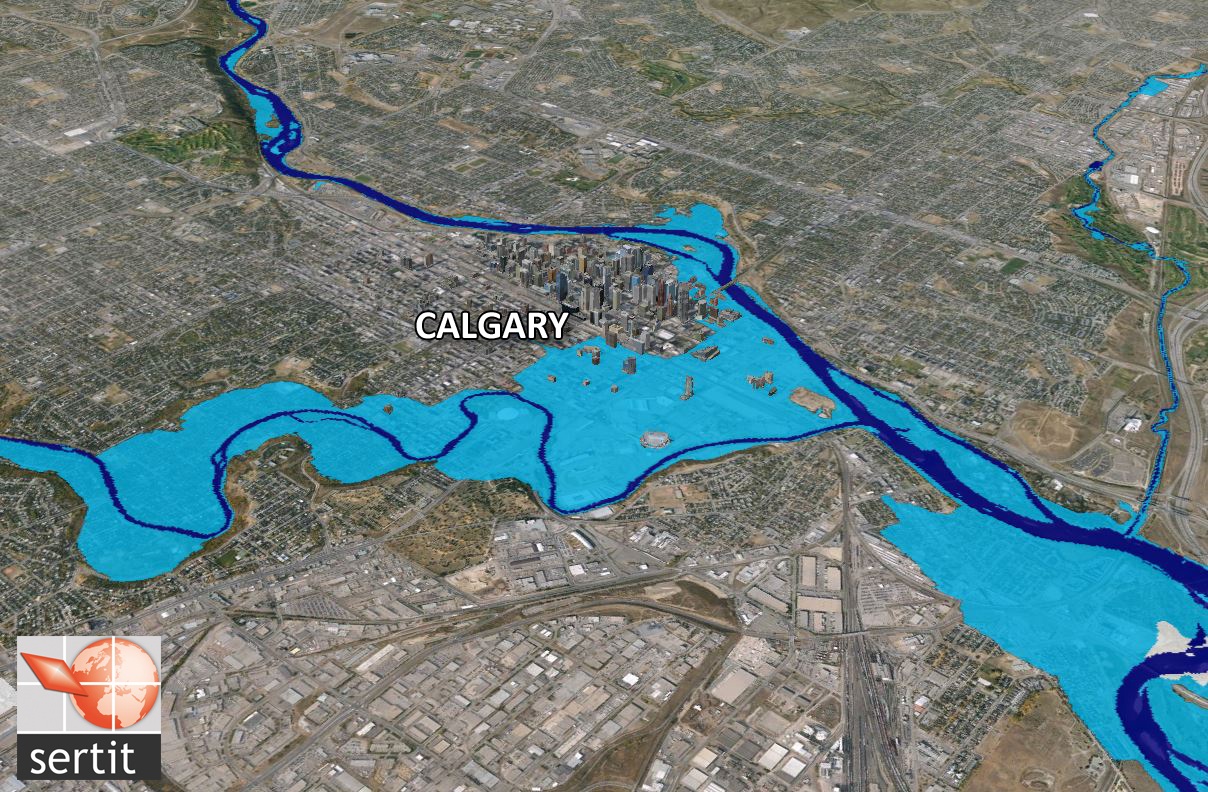
In Calgary, the rivers flooded neighbourhoods, including the downtown, leading to large economic and insured losses. The image here is provided by SERTIT who provided rapid snapshot of the flood footprint over the area of Calgary using satellite images for the insurance industries.
Forecasters have come in for some tough criticism following the largest disaster in Canadian history. A benchmarking review by Alberta Water Smart and a workshop supported by Alberta Innovates has looked at the flood and other international approaches to flood forecasting to highlight any opportunities for the state. At the workshop held in Calgary, the Head of the Alberta River Forecasting Centre presented their hydrological forecasting tools that model discharge accounting for snowmelt, observed and forecast rainfall. However with unprecedented rainfall of 10 to 20 mm per hour for 14 hours and many streamflow gauges being washed out, it’s understandable that forecasting capabilities were challenged. Warnings were issued but it’s clear the scale of the event very quickly escalated. One of the points raised by the forecast centre head was that ‘they want to be better equipped to communicate to meteorologists’ no doubt around the uncertainty in meteorological predictions.
Environment Canada (the federal meteorological bureau) operate various numerical weather prediction models. Looking back at the June floods, their North American Ensemble Forecasting System was indicating a hot spot of rainfall in the key area up to 14 days ahead and their tool the Extreme Forecast Index (EFI) suggested a 60 to 80 percent of extreme rainfall at a 7 to 10 day lead time.
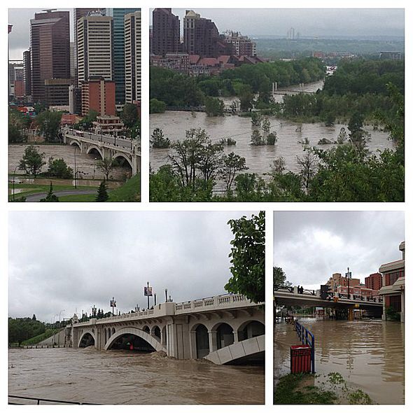
Flooding affecting parts of the City of Calgary, Alberta (Source: Accuweather.com)
Some of the key opportunities for improved flood forecasting highlighted at the workshop included longer lead times for warnings (a look to the five day flood guidance statement perhaps), setting a clear mandate for flash flood forecasting, and cutting the political layers for disseminating warnings direct from the forecast centres to members of the public (Floodline being considered a good example). One of the greatest areas of development could be in the closer integration of meteorological and hydrological forecasting – one of the key recommendations from the UK Pitt Review following the 2007 floods.
Following the workshop reports have been published expressing willingness to develop such medium range hydrometeorological capabilities with the Environment Canada stating “It’s pretty clear that if Environment Canada had had an operational river flow system coupled to our ensemble prediction system, probably because we have faster and bigger computers than the province has, potentially we could have provided (the warnings) faster.”

Accumulated precipitation contours showing the June 19–22, 2013 rainfall event within Alberta’s Rockies and the foothills that triggered the flooding (Source: Wikipedia)
However, the greatest benefit would be deploying this system approach on a regional stage, as a lead scientist from ECMWF states, “Local conditions are likely not to be perfectly captured in a global system, results could definitely improve if a similar model was set up on a limited area.” All of this seems additionally challenging with a complex federal and provincial arrangement.
Political will and drive for developing the flood forecasting capabilities seems crucial especially when water management priorities are focused heavily on drought and water availability. However, the capabilities are there with the respective forecasting centres and research groups; hopefully this flood will provide the catalyst for coupling their capabilities.

Pingback: The Scottish Flood Forecasting Service: 2014 in review | Scottish Flood Forecasting Service