
 The flood forecasting service in Scotland is a partner of the European Flood Awareness System (EFAS); a EU Joint Research Centre (JRC) service which provides probabilistic flood forecast information to more than 48 member organisations across Europe based on the ECMWF deterministic and probabilistic meteorological forecasts and the LISFLOOD distributed hydrological model. Last week (6-7th April), scientists and operational forecasters from across Europe gathered in Seville for the 11th Annual EFAS Partners meeting.
The annual meeting is an opportunity for the users and developers of the EFAS models and data services to gather and exchange information on the service. Discussion included the set up and operation of the EFAS Meteorological and Hydrological Data Collection Centres in Germany (EFAS MDCC) and Seville (EFAS HDCC), respectively, and of developments to the EFAS hydrological model, including the new flash flood layers, which we received notifications from during the December and January flood events (from storm Desmond to the River Don event on the 7th January, 2016). In addition, EFAS introduced their new Rapid Risk Assessment layer which is due to become operation in the summer, 2016, and shares some similarities to the risk assessment products of the SFFS and FFC, and the introduction of a series of webinars to be delivered to partners over the course of the coming years. Of particular interest were the presentations on the Copernicus risk mapping products and by the European Space Agency (ESA). The Copernicus datasets and products can be used to produce near real-time imagery, maps and shapefiles of flood extents during an event, and were used in England and Ireland over the December 2015 stormy period. The products could be used for other natural/man-made disasters as well. ESA were there to promote the wider use of satellite data products in flood forecasting models such as temperature and soil moisture datasets, which can be available on a range of timesteps including daily or even sub-daily in some cases. Both of these satellite products: mapping and satellite derived spatial datasets of climatological and hydrological parameters, are something which could warrant further investigation into the potential use of to improve the models and services provided by both SEPA and the SFFS.

SFFS- FFC presentation on Storm Desmond and Frank

Example slide from joint SFFS-FFC presentation showing the EFAS forecast and and SFFS flood guidance information & forecasts for Storm Frank
The highlight of the conference however was the presentation by myself and Rob Cowling from the England and Wales FFC- and yes I admit to being biased! We, along with Jim Casey from the Ireland Office of Public Works (who did a separate presentation), had been asked to give presentations on the recent Winter floods in the UK and Ireland in December. Due to limitations on time, and to show cross-organisation co-operation Rob and I decided to present together, enabling efficiency in delivering context to the flooding through a background introduction including of our operational models, the UK climate and hydrological regimes in general, before detailing the impacts and our forecasting performance during the Storm Desmond and Frank events. The presentation was well received with many questions asked about our forecasting systems and use of EFAS during the events.
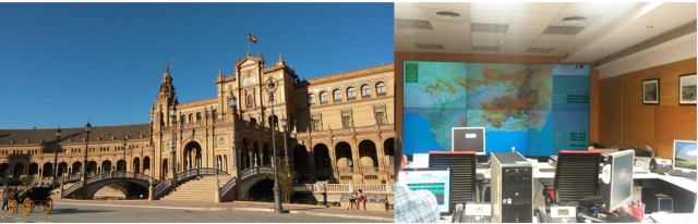
The beautiful office location and Ops Room of the Guadalquivir river authority, Seville.

Old friends and colleagues on the roof of Seville cathedral
In truth though, the highlight of the conference was the city of Seville itself which warrants more time for exploration that I had. The organisers of the meeting deserve congratulations on a well organised and very informative and productive meeting, but also our thanks in ensuring we had some exposure to the delights of the city. They organised a trip to the cathedral (the 3rd largest Gothic cathedral in the world) and its rooftops, before a fabulous dinner on the Wednesday night, plus a trip to the monitoring and control room of the Guadalquivir river authority who have the pleasure of working in a spectacular location (see picture). It’s fair to say we all left feeling a little envious of their office location, although they are missing the fair mountains I can see from my office window (through rain!).
