In the second of a series of articles on how the mountains of Scotland influence our approach to monitoring and flood forecasting, Dr. Andrew Black writes about the role of hydrometric observations.

“Continually rising global temperatures over the coming century might easily be associated with a lessening in the importance of snowmelt in many parts of the world. However, the ‘Beast from the East’ of 2018 and the wintry conditions as I write this in early 2021 show that snow and its subsequent melt very much remain part of Scottish climate for the time being, especially in mountain and upland landscapes, from where Scotland’s largest river systems flow. It is not uncommon for large floods in Scottish rivers to be caused partly by snowmelt (Figure 1).
This article seeks to examine the potential benefits and pitfalls of using tipping bucket rain gauge (TBR) data from higher elevations for flood forecasting purposes during snowy conditions.
Observations during snowfall
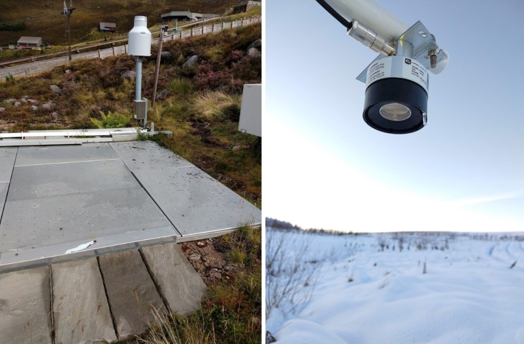
Observations may be direct or indirect. The most direct observations can be obtained from instruments designed specifically for monitoring snow water equivalent or snow pack depth (Figure 2). Weighing gauges and acoustic distance measuring equipment is relatively rare and, even when they are available, they provide information only for one particular point, and may reflect local influences such as aspect combined with snow blow after initial snowfall. Webcams such as those hosted by Traffic Scotland and Winterhighland provide visual assessments which can be useful for assessing conditions, especially the former which include infrared capability for night-time.

By way of indirect observations of snowfall, TBRs are more commonly available, so there are advantages in terms of geographical coverage, but users of the data from these gauges must beware of possible problems arising from under-catch and the timing of melt. A helpful early sign of snowfall is the occurrence of rainfall at low altitudes while adjacent higher-altitude TBRs record minimal or zero precipitation. Reliable air temperature data helps in interpretation. A good example is shown in Figure 3: intense rainfall at low elevation was confirmed by eye-witnesses, while adjacent gauges on higher ground registered no tips.

Observations during melt events
Problems may arise with use of TBR data during snowmelt events owing to possible under-catch of snow, due to aerodynamic effects and also the timing of recorded gauge tips. However, some gauges may provide an insight into imminent high runoff on at least some occasions. The same Feshie snowmelt event of December 2018 is illustrated in Figure 4 showing the lag between TBR accumulations at a range of elevations from 260 – 900 m OD and river levels at a similarly wide range of elevations.
While it may be interesting to examine the lag time in various ways between TBR accumulations and river level responses, one gauge in Figure 4 stands out – an ARG100 gauge at 520 m which was situated on the east side of a small hummock in the lee of prevailing winds – not normally best practice for gauge siting (and since decommissioned). This gauge began to record at the same time as other gauges, but had recorded 33.2 mm in the first 12 hours of the event, by which time none of the other 5 gauges had recorded more than 9.2 mm. Similar tendencies are found in other snowmelt events, suggesting the 520 m gauge may be able to offer some ability to indicate the onset of a major snowmelt event: the gauge possibly benefits from being especially exposed, allowing faster melt than in other gauges, while also giving a crude indication of the amount of snow in the catchment.

It must be more typical to regard protruding rain gauges as a problem leading to under-recording of snowfall amounts and unduly early recording of melt compared with the majority of the snowpack. Figure 5 illustrates a set of gauges in melting snow at the Talla gauge comparison site at 425 m OD. At the time of the visit, none of the above-ground gauges contained any snow, save for the gauge buried in the pit, with its rim at ground level. The above-ground gauges clearly provided a misleading characterisation of the melt process – of course, the gauges are rain gauges not snowmelt gauges.


Concluding remarks
The Feshie network of TBRs captures data from an unusually large range of altitudes, from 260 – 900 m OD, and provides an abundance of data with which to examine snowmelt events. This brief review illustrates how, by extending from the valley bottom up to some of the highest ground, it is possible to obtain a much fuller, if inevitably imperfect, portrayal of snow-related fluxes from the Cairngorms, which would be of value to a flood forecasting duty officer.
TBRs protruding above the ground surface may be unrepresentative of the general timing of melt in a snowpack, but might on some occasions be of value in giving early warning and an approximate snow water equivalent for an imminent snowmelt flood.”
Acknowledgements
Research sponsors and collaborators at Wildland Limited, Cairngorm Gliding Club, Borders Forest Trust, Newcastle University/Environmental Measurements Ltd and Michael Pollock.
